 |
| Middle Sister Summit |
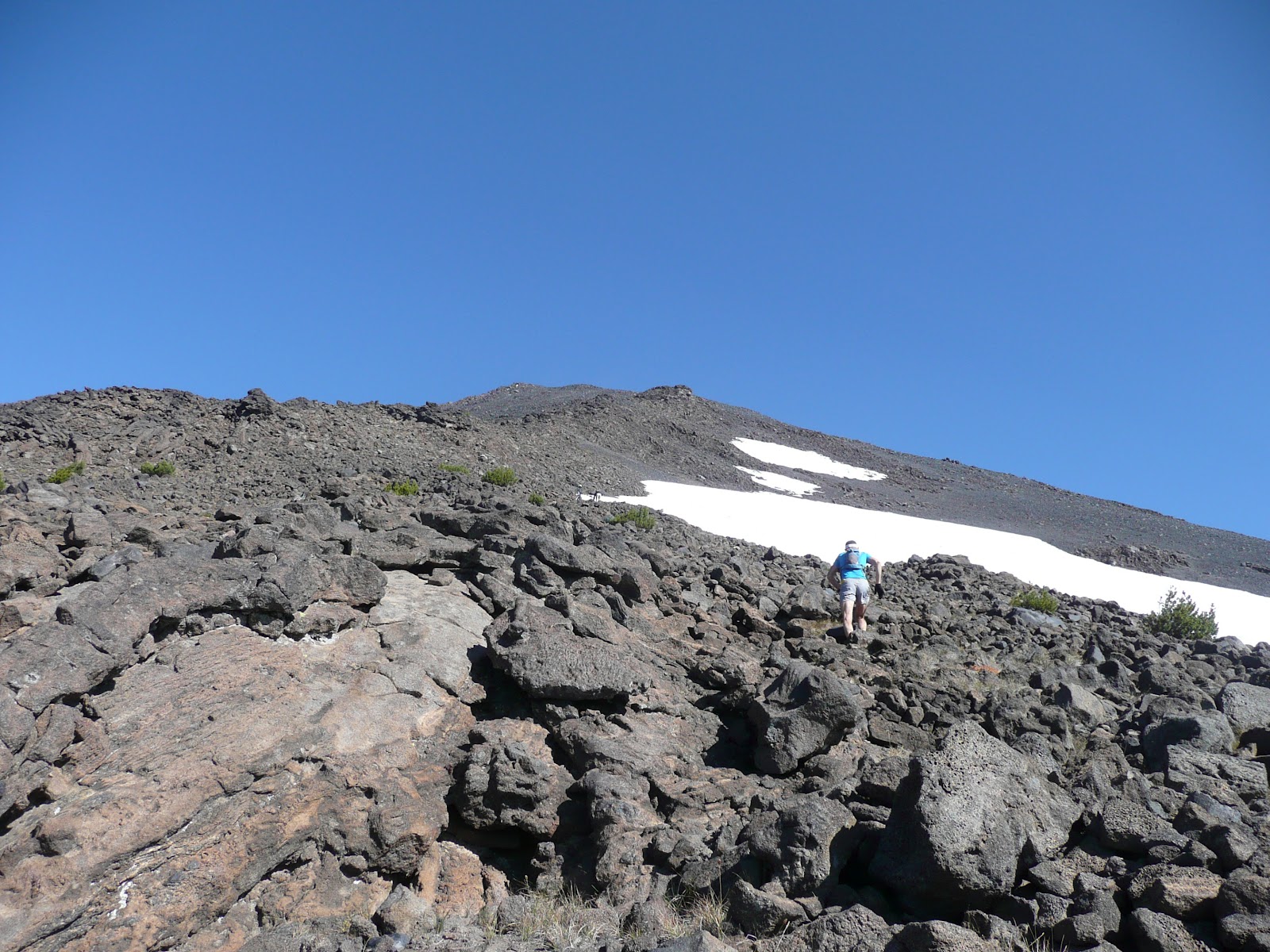
This morning I got up early to run with fellow Bend-ite (Bender?), Rod Bien in the Cascade Mts. We drove out to Pole Creek trailhead, ran a beautiful route to the steep climb up to Middle Sister (10,047ft), which was a scree-slope of clambering. But the views were incredible. We even spotted a small fire starting miles away and I commented that we had a great viewpoint for the Forest Service to spot fires.
The downhill was some of the best running/sliding I've ever done with a glacier and jumps by crevasses. All the time with stunning views and the fire we spotted looked like the eruption of a volcano over North Sister. We ran back, gradually speeding up as we saw the parking lot looked very close to the fire. Then within the last 100m we saw smoke everywhere and fire on our right. The rough road back out was completely filled with smoke but we decided to see if it was passable (not a smart idea). After a few feet we saw a car on fire, quickly reversed and went up a dirt track that our map showed was a dead end.
Our best bet looked to be to park the car as far from the fire as possible then hike out or get rescued (we called the emergency services, of course), hoping the car wouldn't be burnt to a crisp. There were maybe 20 other cars in that parking lot and I'm sure they're all burnt-out husks now. 15 mins later and ours would have been as well.
Then we saw a sketchy dirt road going parallel to the fire and decided to see if that would get us out as our road was definitely a dead end. Two hours later and after numerous calls to the emergency services, we got around the fire even though our map didn't show the roads we drove, despite it showing all the forest fire roads...
Rod's car was a little worse for wear but we were glad to be safe and out of there. It was never really dangerous once we got out the parking lot, but we had no idea whether we'd need to leave the car and hike out due to inaccessible roads or dead ends.
That fire (the Pole Creek Fire) is huge and the closest to Bend and Sisters this year. Plenty of others are stuck out there camping or hiking and their cars are lost, so I hope they all make it out safely and don't try to get back to their cars. The forest around there will be scarred for years so the photos below are the last ones for a long time of the greenery in that area.
But it was the most beautiful and fun run I've ever been on, topped off with more drama than necessary. Think I'll have a beer now. We were lucky but also made sure people knew where we were going and how long we should take. We also had more food and drink than was needed for the run and extra clothing. The mountains and forests certainly deserve respect and fires are not to be taken lightly (trust me, we didn't).
I won't label the mountains in the photos as it'd take too long, but these shots include Bachelor, Broken Top, South/Middle/North Sister, Jefferson and Hood, spanning maybe 100 miles of the Cascades.
10 days after the fire started, it reached over 24,000 acres and here's some video from local firefighters and helicopters.


 |
| Driving away from the fire on back-roads. |


Wow, really awesome photos. Truly a stunning place to run by the look of it, and glad you both survived the added drama of the day.
ReplyDeleteLuckily I didn'tt have the same issues running through the Northants countryside this morning.
Mind you I didn't have those epic views either!!
Enjoy the well deserved beer.
Awesome pics....we were in Sisters for the Folk Festival and saw ash coming down from the fire...scary stuff. Glad you made it out safely.
ReplyDeleteSo glad to hear this has a happy ending. What an adventure... thanks for sharing!
ReplyDeleteYour photographs are gorgeous. You were so close, but it sounds like you guys were wise enough to get out of there and not dally. You're runners...of course you don't dally.
ReplyDeleteThanks for the pics...quite different looking than a topography map. Were any of the bodies of water (in pics) identifiable by your map? Just kind of geeky about the location. No biggy...get some rest...and bless you for sharing.
ss
dude, we told you the trail head was closed. you put people at risk. glad you are ok
ReplyDeleteAnonymous,
ReplyDeleteThese two started early in the morning when the trail head was open (and there was no fire) and did not see anyone at the trail head when they returned. You must be thinking of someone else. Luckily, it sounds like everyone was safe.
your post is that good ...
ReplyDeleteplease follow me back ..